Photography and mapping from Afar
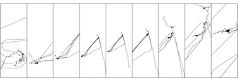
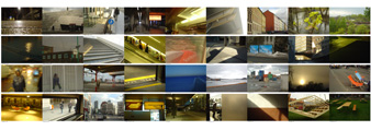
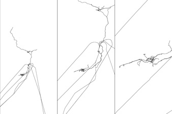
Nine boards, four images each, above a set of GPS tracks drawn as simple lines. The images show a transition from London to Oslo across a winter and spring. The maps scale to the extents of the images above them; what you see on each board is the journey between the pictures.
‘Afar’ was an exhibition at Råhuset in Copenhagen, 8–23 July 2004, where 25 international artists produced work responding to the word ‘afar’. The brief looked for connections across architectural, choreographic, street-art, design, audio, photographic, VJ, video, fashion, painting and creative-writing practice.
The piece
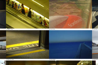
For three months I recorded every walk, drive, train journey and flight I took, while photographing spaces and places from daily life. Each image in the exhibition is captioned with location information and keyed to a point on the map below it. The images show spatial transition from one country to another, and a change of season.
The maps are GPS tracks, visualised as simple lines. The scale of each map is decided by the extents of the image locations. The maps give a sense of transition; scale and movement are emphasised.
This is the first step towards a visual language for spatially located imagery, personal travelogues as communication and as artefacts of personal memory.